THIS ISN'T ANOTHER REPORT.
IT'S THE RECORD YOUR
PORTFOLIO IS MISSING.
Property Vault turns scheduled property visits into organized, timestamped intelligence for property management companies and serious portfolio owners.
See how visible conditions, documented changes, priority concerns, advanced documentation, and property opportunities can be organized into one professional record your team can actually use.
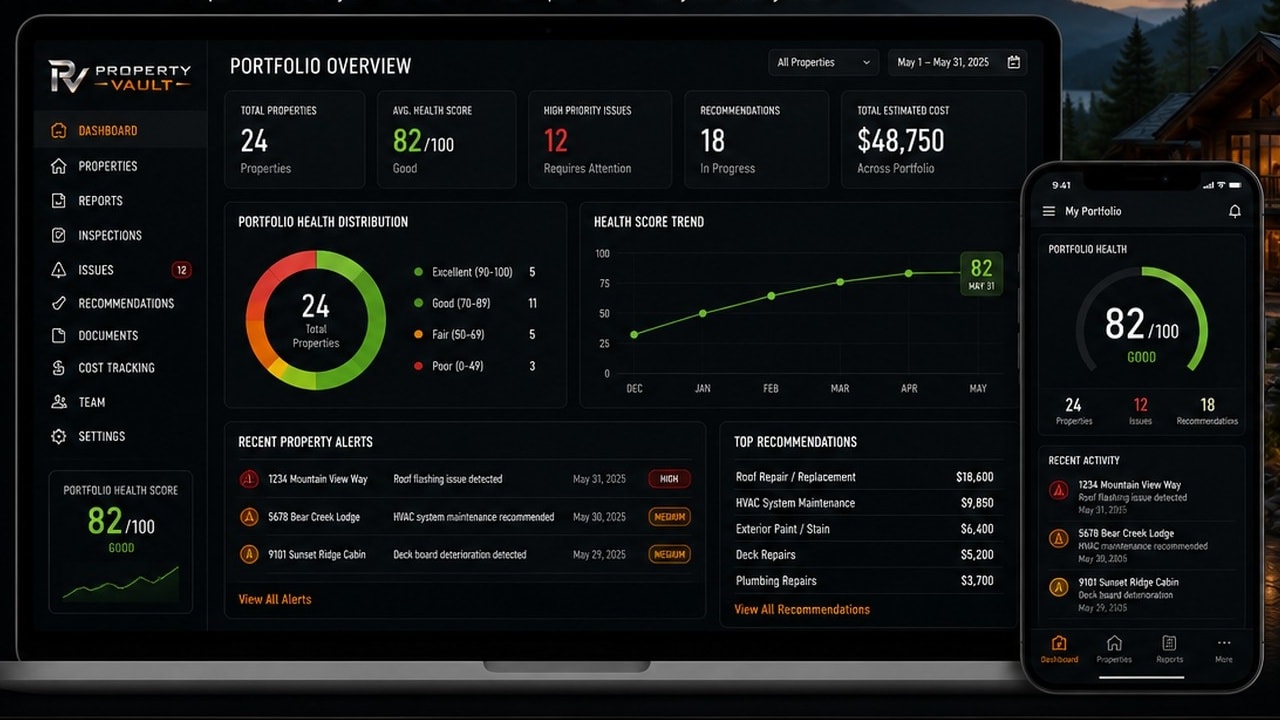
ILLUSTRATIVE SAMPLE — Property details, images, findings, measurements, and scores shown on this page were created to demonstrate the Property Vault reporting format and do not represent an active client property.
Portfolio Intelligence Program
ONE PORTFOLIO.
ONE ORGANIZED VIEW.
Qualifying portfolio clients receive organized reporting across enrolled properties—helping management companies and owners review documented conditions, visible changes, priority concerns, and property opportunities from one clearer portfolio record.
 Property Condition Report
DOCUMENTATION PRIORITY
CONDITION RECORD
DOCUMENTATION AREA BREAKDOWN
FINDINGS
6
2 Priority
VISITS
MONTHLY
Monitoring
ACCESS
DOCUMENTED
Accessible areas at time of visit
RECORDS
CURRENT
Organized
Property Vault scores are internal documentation-priority indicators. They are not engineering, safety, code-compliance, appraisal, insurance, or legal determinations.
PRIORITY FINDINGS
6 ITEMS · SORTED BY PRIORITYPriority levels organize recommended follow-up and are not professional safety, engineering, or code determinations.
Exterior roof condition — north face
A visible exterior condition was documented. Evaluation by a qualified roofing professional is recommended.
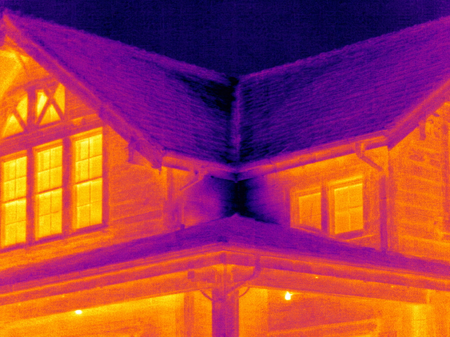
Thermal pattern — HVAC equipment area
A thermal pattern differed from surrounding surfaces. Further evaluation by an appropriately qualified professional is recommended.
Deck surface condition — visible change documented
A visible deck condition was documented for follow-up by a qualified contractor or engineer.
Exterior wall surface pattern — west elevation
A surface pattern was documented near the exterior wall. Property Vault did not determine its cause. Available documentation should be reviewed by the property owner and the appropriate licensed professional.
Electrical panel area — documentation noted
A condition near the electrical panel area was documented for owner review and follow-up with a qualified professional.
Pool equipment enclosure — condition documented
A visible condition near the pool equipment enclosure was documented for professional review.
DOCUMENTATION COMPLETENESS
Internal documentation-priority indicator only
Property Intelligence Components
SIX LAYERS OF DOCUMENTATION.
ONE CLEARER PROPERTY RECORD.
Each Property Vault report is built around consistent field documentation and organized reporting. Available components vary according to the selected program, defined documentation schedule, property requirements, accessibility, weather, and operating conditions.
Drone Aerial Documentation
Eligible aerial documentation captures rooflines, exterior elevations, decks, drainage areas, access points, surrounding terrain, and other locations that may be difficult to document from the ground.
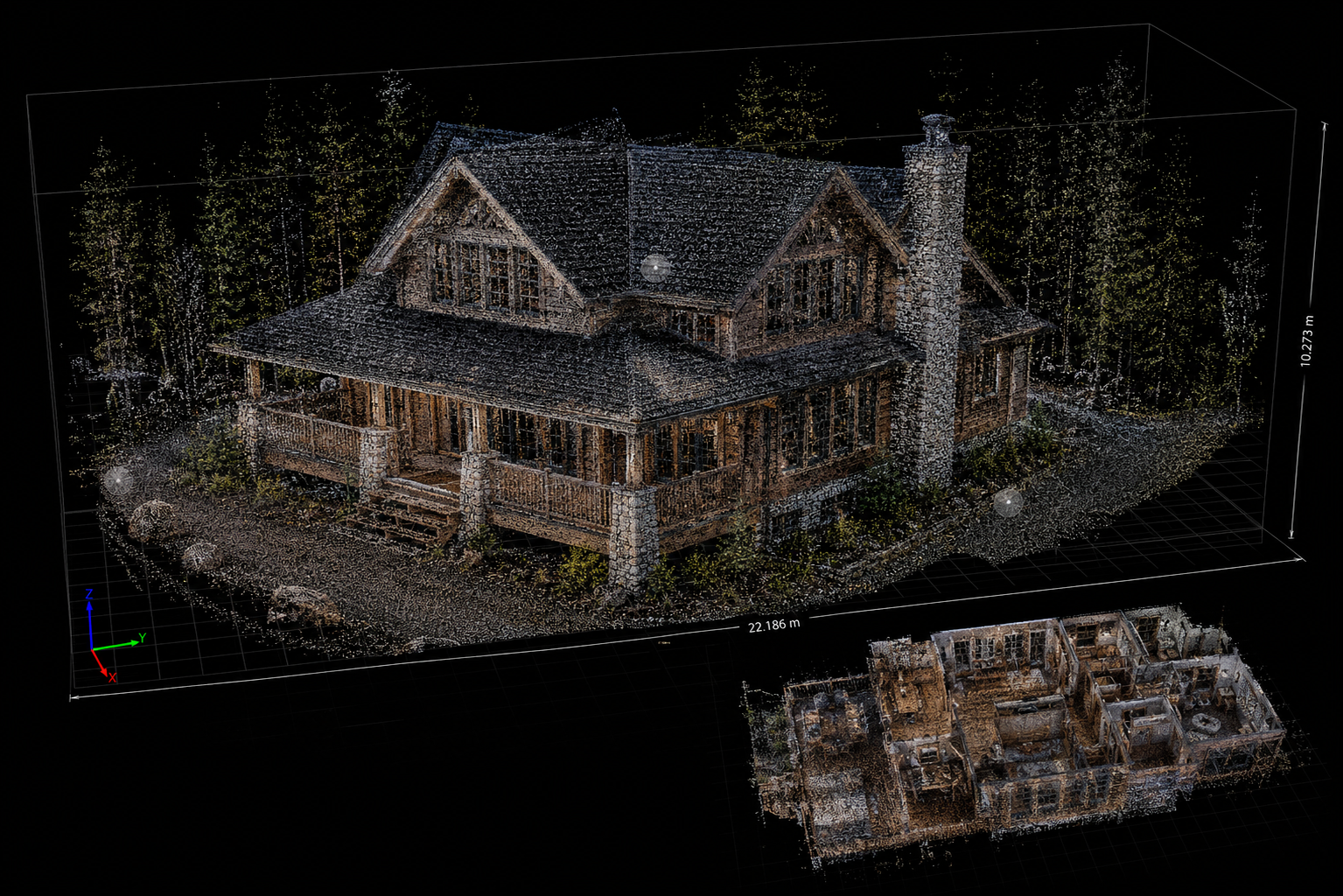
LiDAR 3D Mapping
LiDAR captures detailed three-dimensional spatial data that creates a measurable digital property record and provides comparison points for documented spatial changes over time.
Professional Thermal Imaging
Professional infrared imaging documents surface-temperature patterns and anomalies that may deserve additional evaluation beyond an ordinary visual walkthrough.
Ground Photography and Video
Every scheduled visit includes organized ground-level photography and video documenting visible conditions across accessible property areas.
Documentation-Priority Scores
Internal priority indicators organize documented observations and help management teams determine what may deserve attention or professional follow-up first.
Professionally Structured Reports
Timestamps, consistent evidence identification, organized media, and professional formatting create a clearer record for owner, manager, contractor, and authorized professional review.
Technology availability and frequency vary by service program, property requirements, accessibility, weather, and operating conditions. Eligible commercial drone flights are performed by FAA Part 107-certified remote pilots and remain subject to applicable airspace and flight requirements.
Why the Record Matters
WHEN QUESTIONS START,
THE RECORD IS ALREADY THERE.
Documented Conditions
Every scheduled visit adds timestamped, consistently organized documentation of visible property conditions across accessible areas.
Change History Over Time
Recurring visits create comparison points showing what was visibly documented, what changed, what remains unresolved, and what may deserve attention next.
Portfolio-Level Intelligence
Consolidated reporting gives management companies and portfolio owners a clearer view across enrolled properties—without searching through scattered photos, notes, work orders, messages, and memory.
Documentation That Can Support Your Position
When repair decisions, owner questions, contractor conversations, disputes, insurance conversations, or other property concerns arise, clients have organized, timestamped documentation they can provide to the appropriate professionals supporting their next decision or defense.
Report Components May Include
Property Vault provides property-condition documentation and recurring property intelligence. Reports document accessible conditions observed during scheduled visits and may identify items deserving additional evaluation. Property Vault does not provide legal, insurance, engineering, appraisal, code-compliance, or diagnostic conclusions, and does not guarantee claim outcomes, dispute results, property performance, or the prevention of damage.
YOUR PORTFOLIO SHOULDN'T BE
MANAGED WITHOUT A RECORD LIKE THIS.
Every enrolled property begins with a paid baseline. Then choose Monthly, Every Other Month, or Quarterly visits to build the condition history your team has been missing.
Portfolio programs are designed primarily for property management companies and serious owners responsible for five or more properties.